
Four traffic options for Sebastopol's downtown core
The city's consultant, Fehr & Peers, submitted the final four options to the planning commission on Tuesday night


The city’s Caltrans grant consultant, Fehr & Peers, appeared before the Sebastopol Planning Commission on Tuesday evening to present its final four options for the reconfiguration of traffic in downtown Sebastopol, winnowed down from the 11 options presented at the last public meeting in May.
The goal of the evening was for the Planning Commission to provide feedback on the four alternatives and approve the metrics the consultants had created to guide their final work on this project this fall.
Here are the four alternatives:
Note: In the designs below, the purple line represents a two-way street, and the green line represents a bike lane. The blue represents a one-way street going north, and the red represents a one-way street going south.
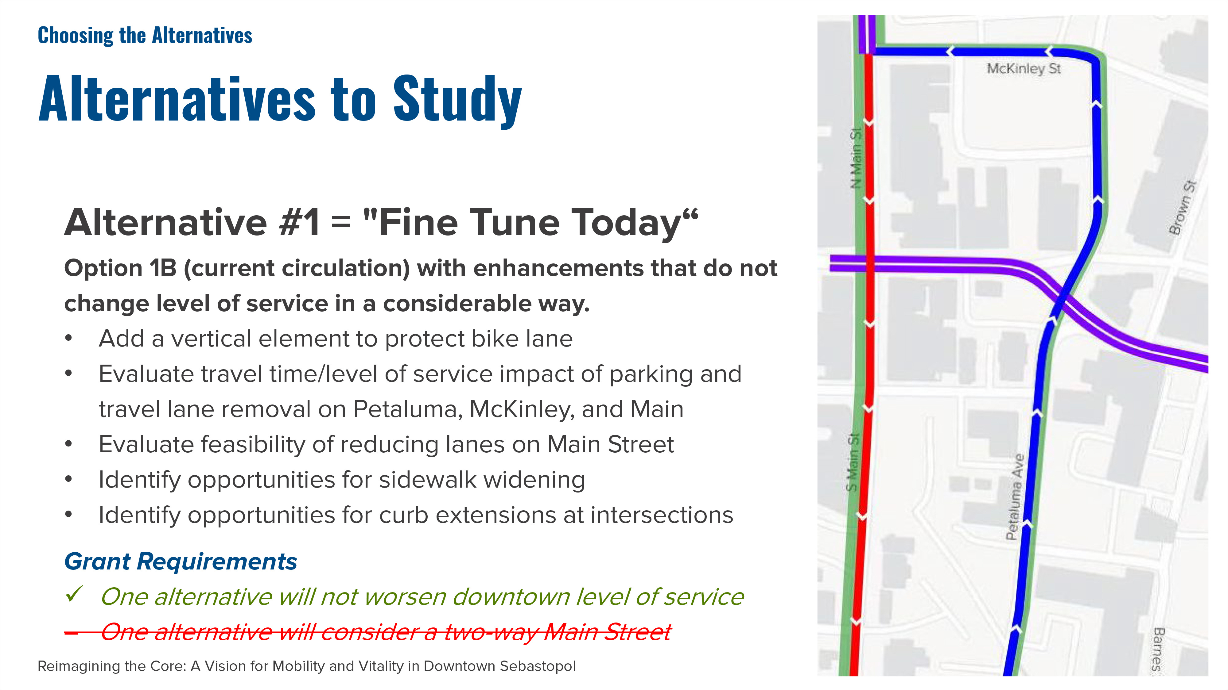
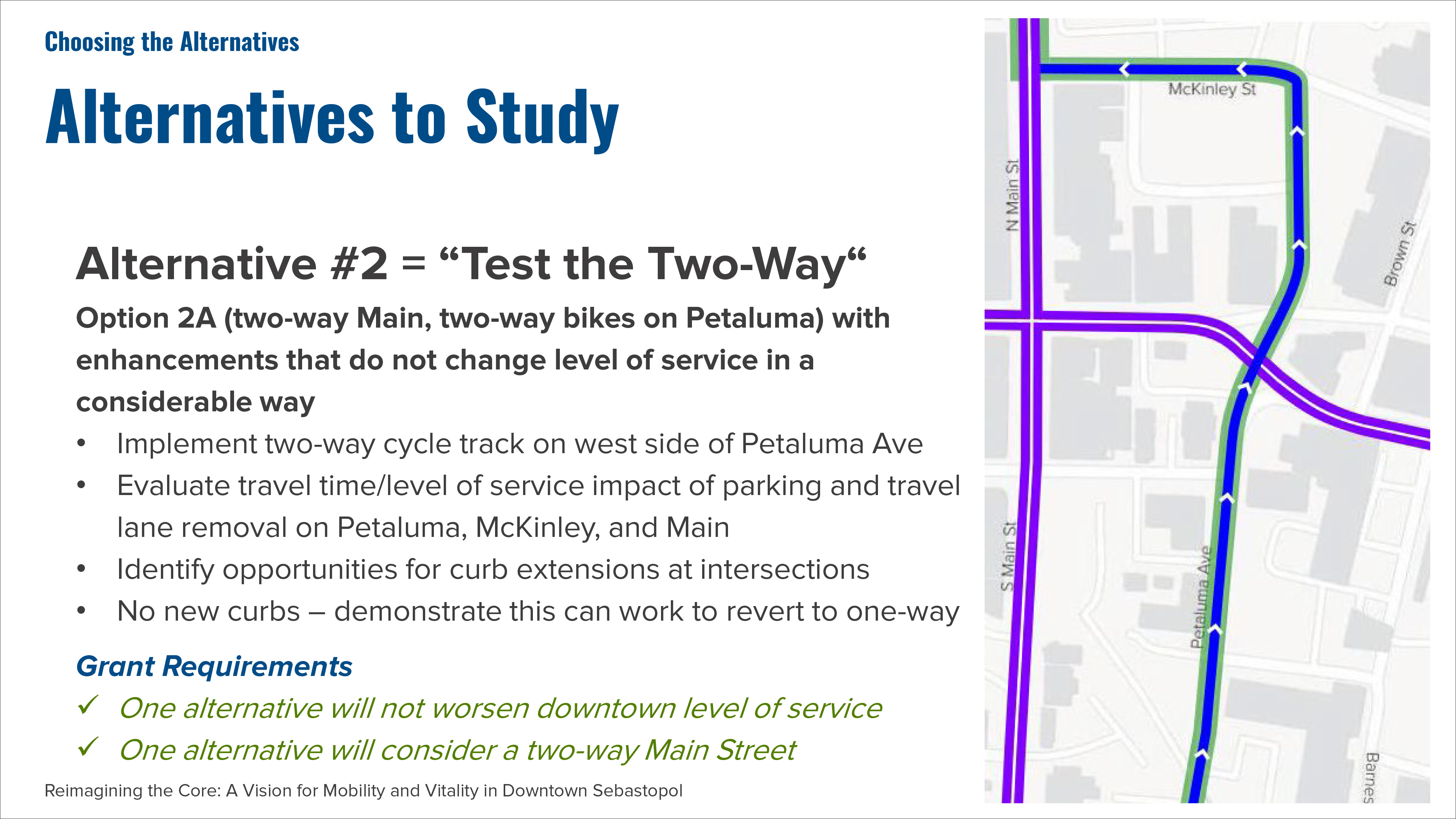
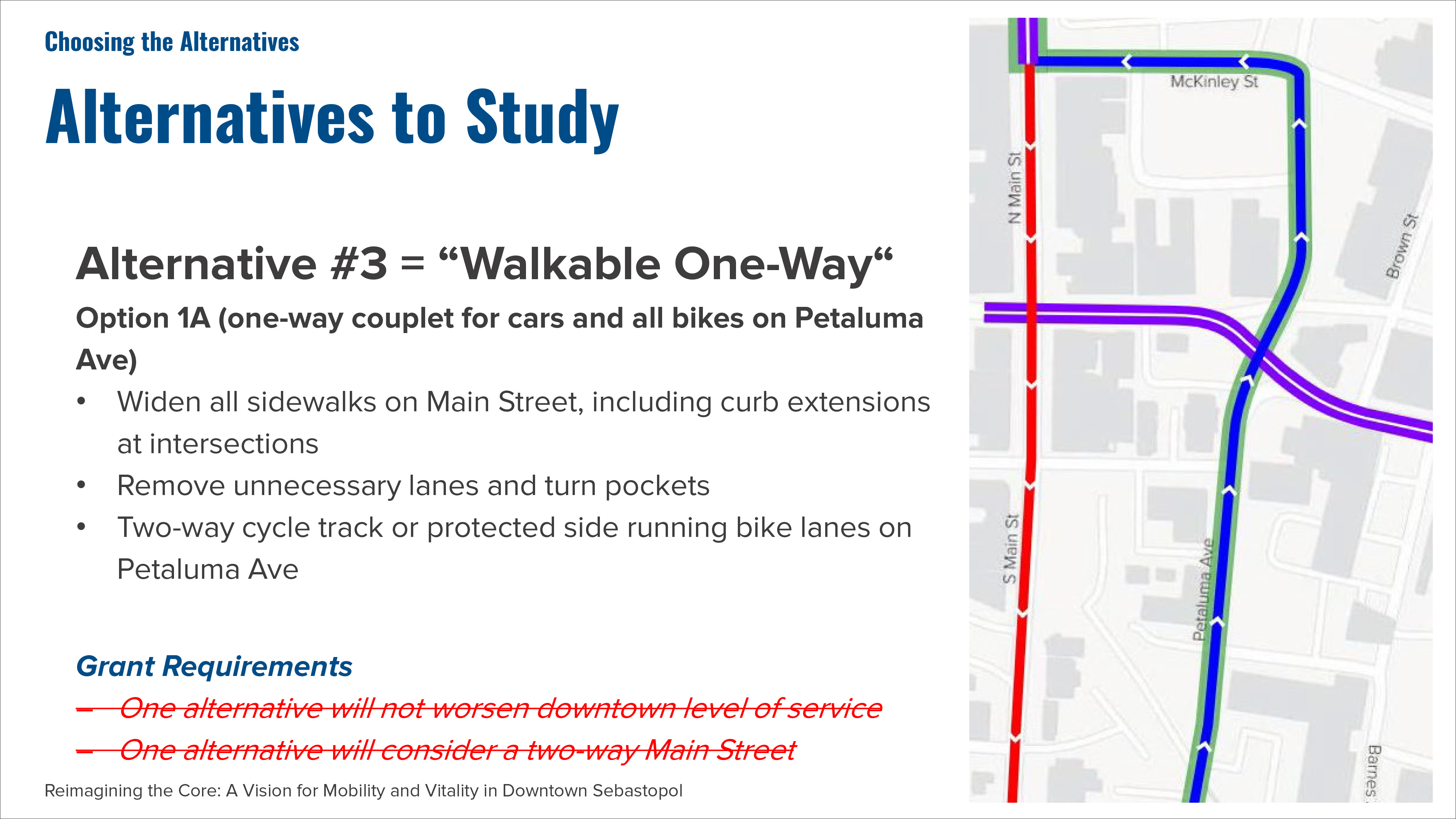
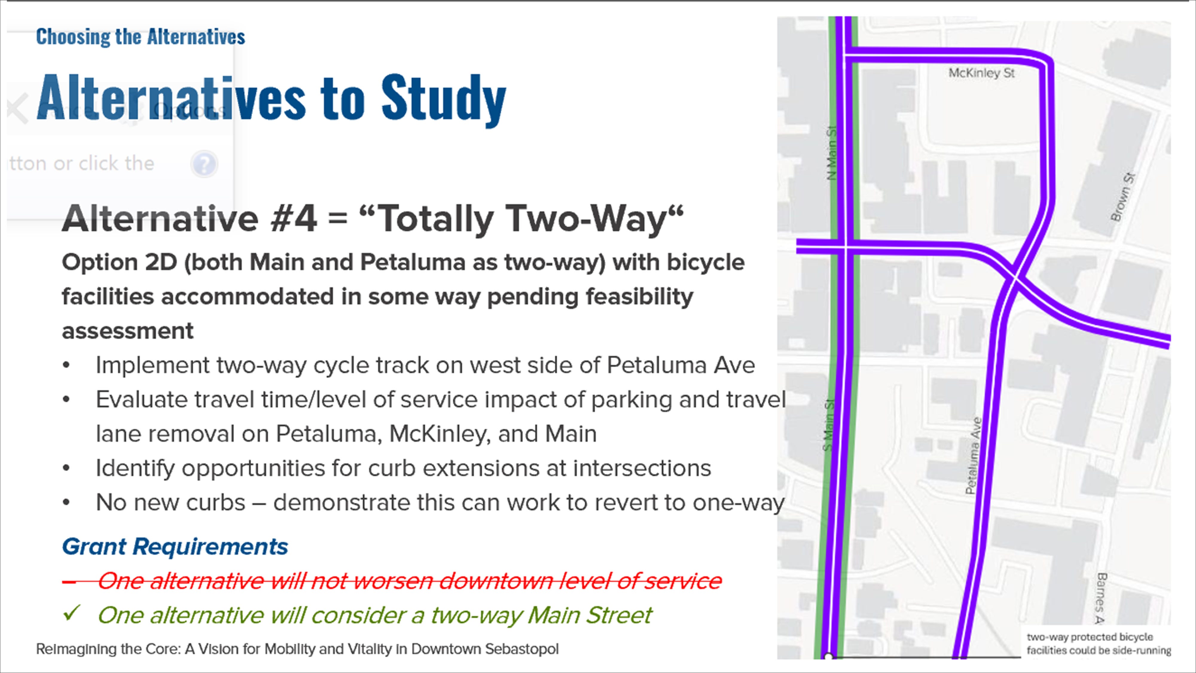
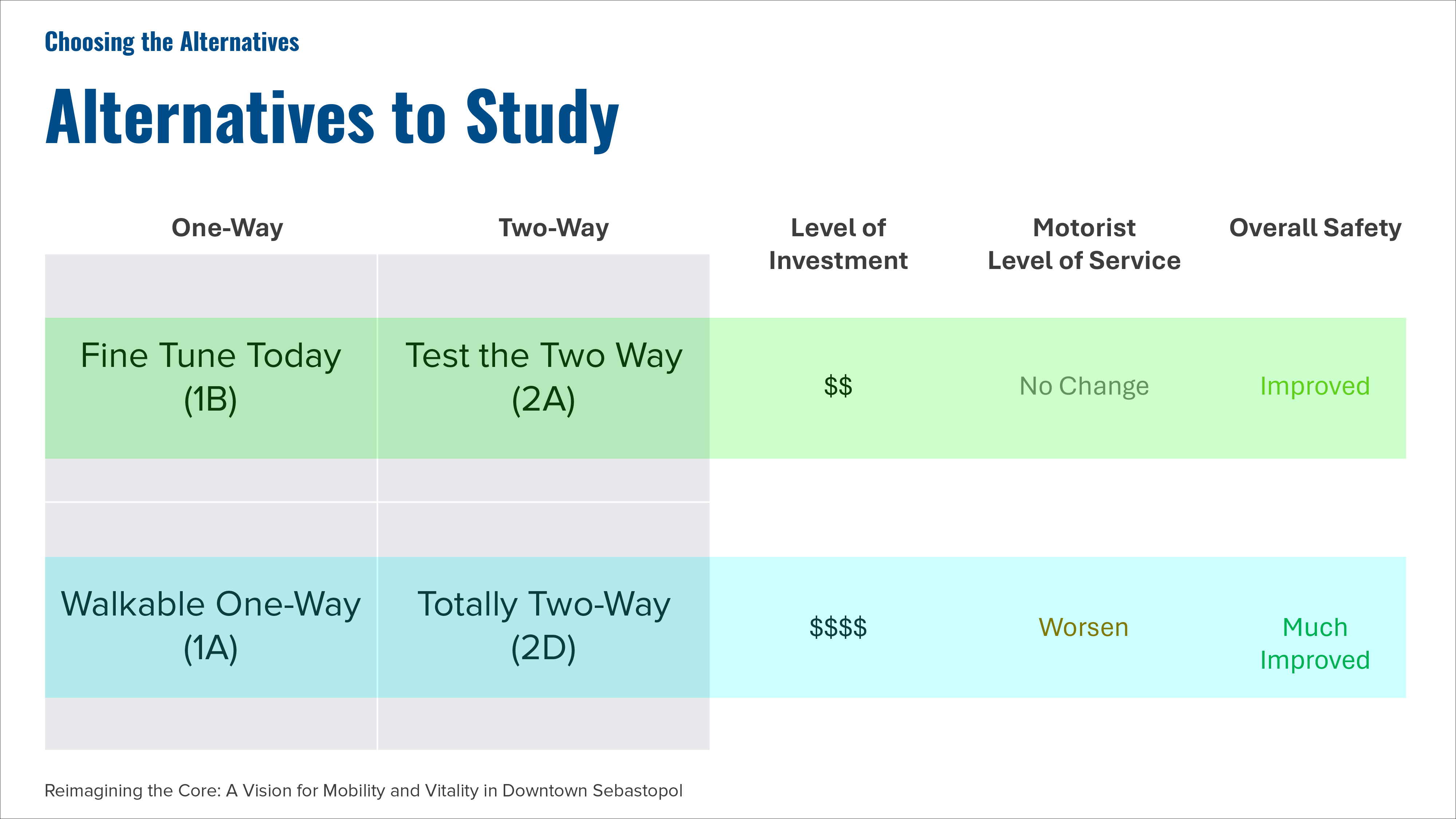
The four alternatives include two relatively inexpensive approaches (Alternatives 1 and 2) and two considerably more expensive ones (Alternative 3 and 4). The less expensive alternatives were designed in such a way that they could either stand alone or act as the first phase of development for Alternatives 3 and 4. In other words, Alternative 1 (Fine Tune Today) could be a preamble for Alternative 3 (The Walkable One Way) and Alternative 2 (Test the Two Way) could be the preamble for Alternative 4 (Totally Two Way).
A bit of history
In August 2023, the City of Sebastopol was awarded a Sustainable Transportation Grant from Caltrans for $230,178. The grant required a local match of $29,822, which the city contributed, for a total of $260,000.
The City hired a consultant, Fehr & Peers, and starting in 2024, they began holding meetings and workshops to get input from the community on how they envision the downtown area of Sebastopol.
Based on their first public workshop event in November 2024 and in discussions with various stakeholders, the consultants began to develop a list of traffic alternatives for Main Street, McKinley Street, Petaluma Avenue, and Bodega Avenue. Options included various bike lane configurations, one-way and two-way versions of downtown streets. They even created options that involved closing off one or two blocks of Main Street to all car traffic. The consultant and City staff then held another public workshop in May of 2025, where members of the community were asked to provide feedback on 11 different alternatives.
The four alternatives before the Planning Commission this week came about as a result of that feedback.
Working within constraints
At the beginning of the evening, Fehr Peers consulting Geoff Rubendall noted that all the alternatives are required to meet Caltrans Complete Street Design Standards:
Design decisions shall support an operating speed of 25 mph. (Traffic currently averages 29 mph.)
Travel lanes shall be 10.5 to 11 feet. (Lanes are currently 12 feet wide.)
Bike lanes must be separated and protected from cars. (Right now, they’re just striped lanes with no physical buffering.)
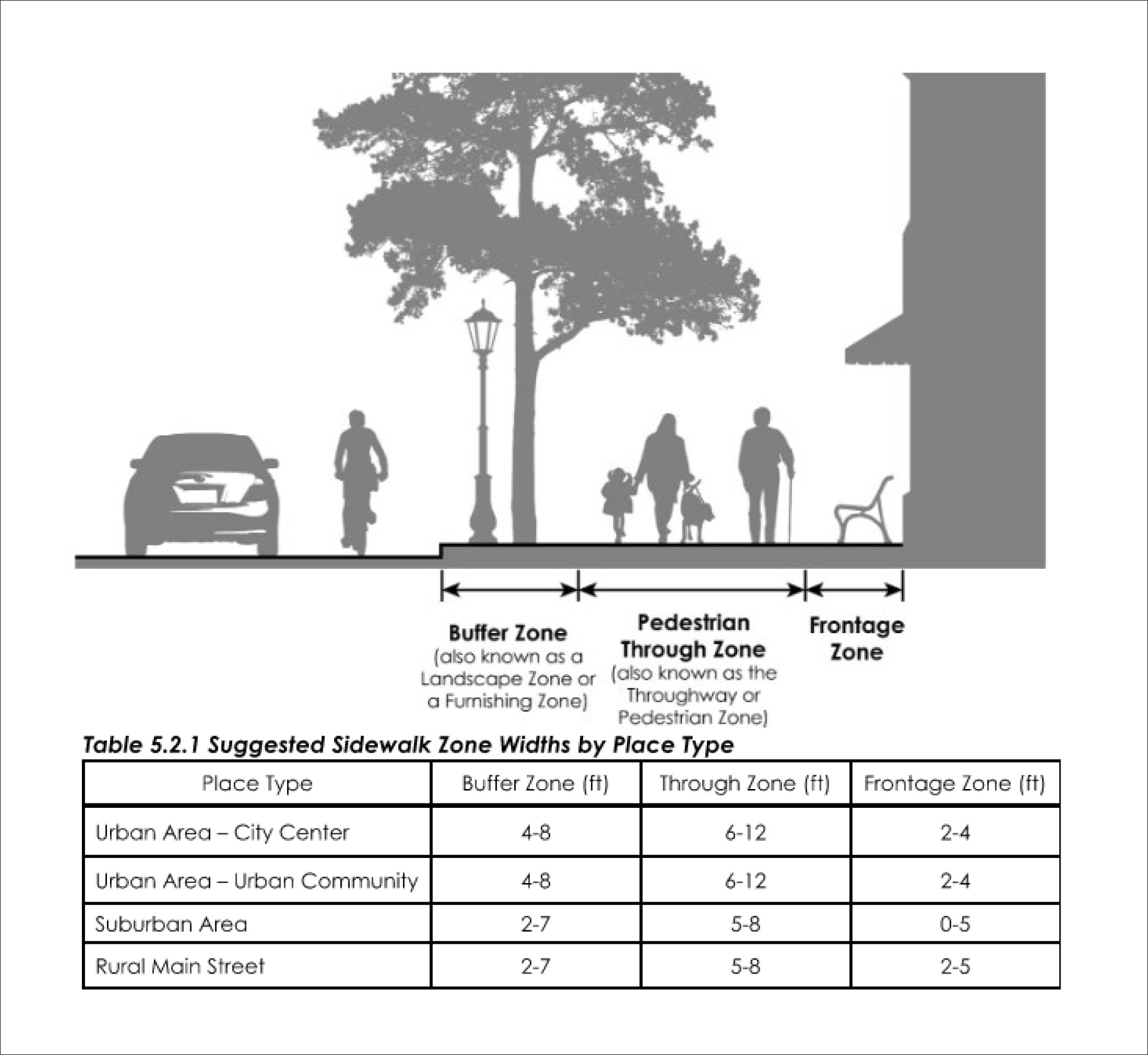
Sidewalk zone shall be maximized for optimal safety and comfort. (Sebastopol’s sidewalks are currently 5- to 10-feet wide.) See the new design standards for sidewalks in the illustration below.
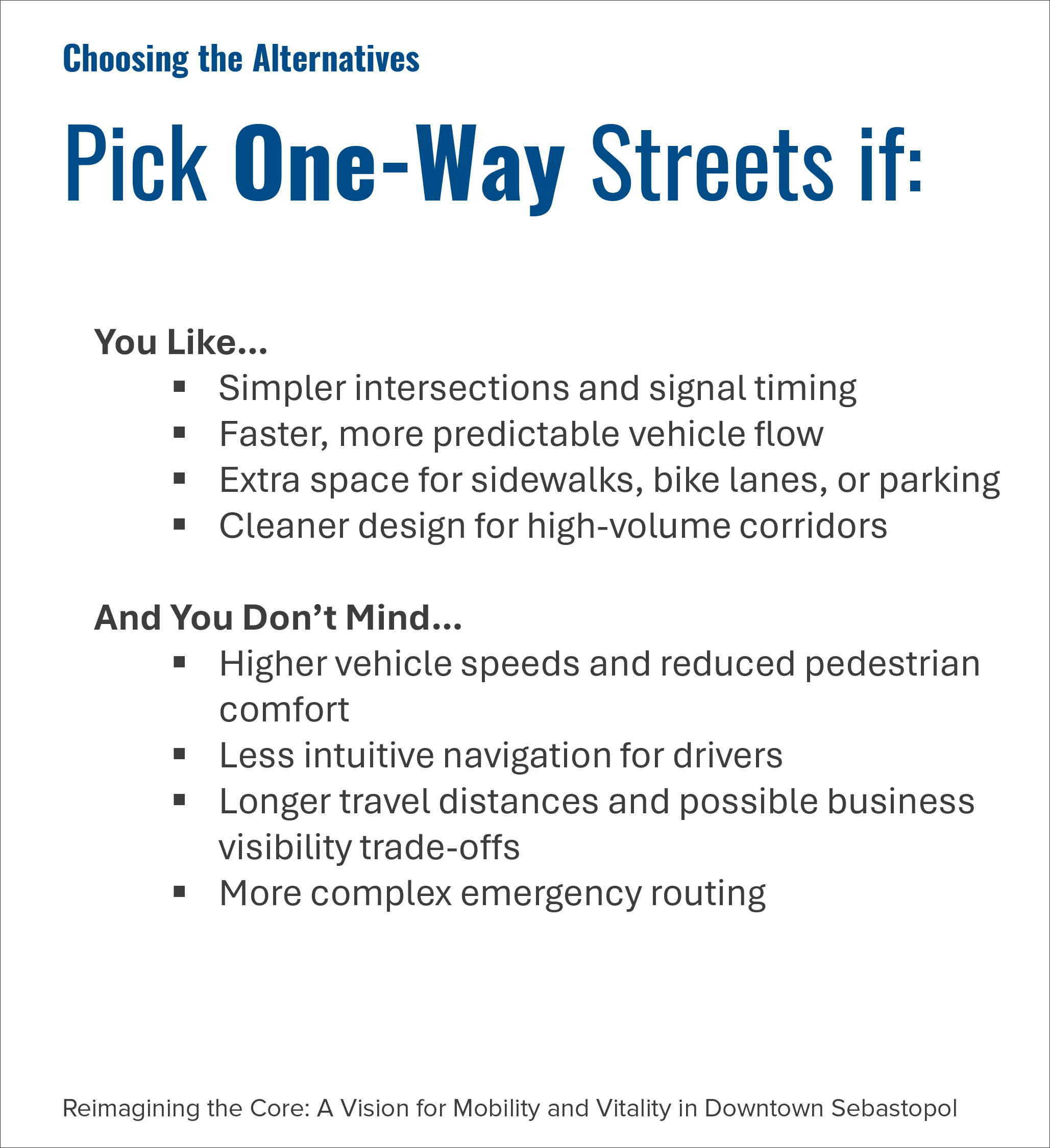
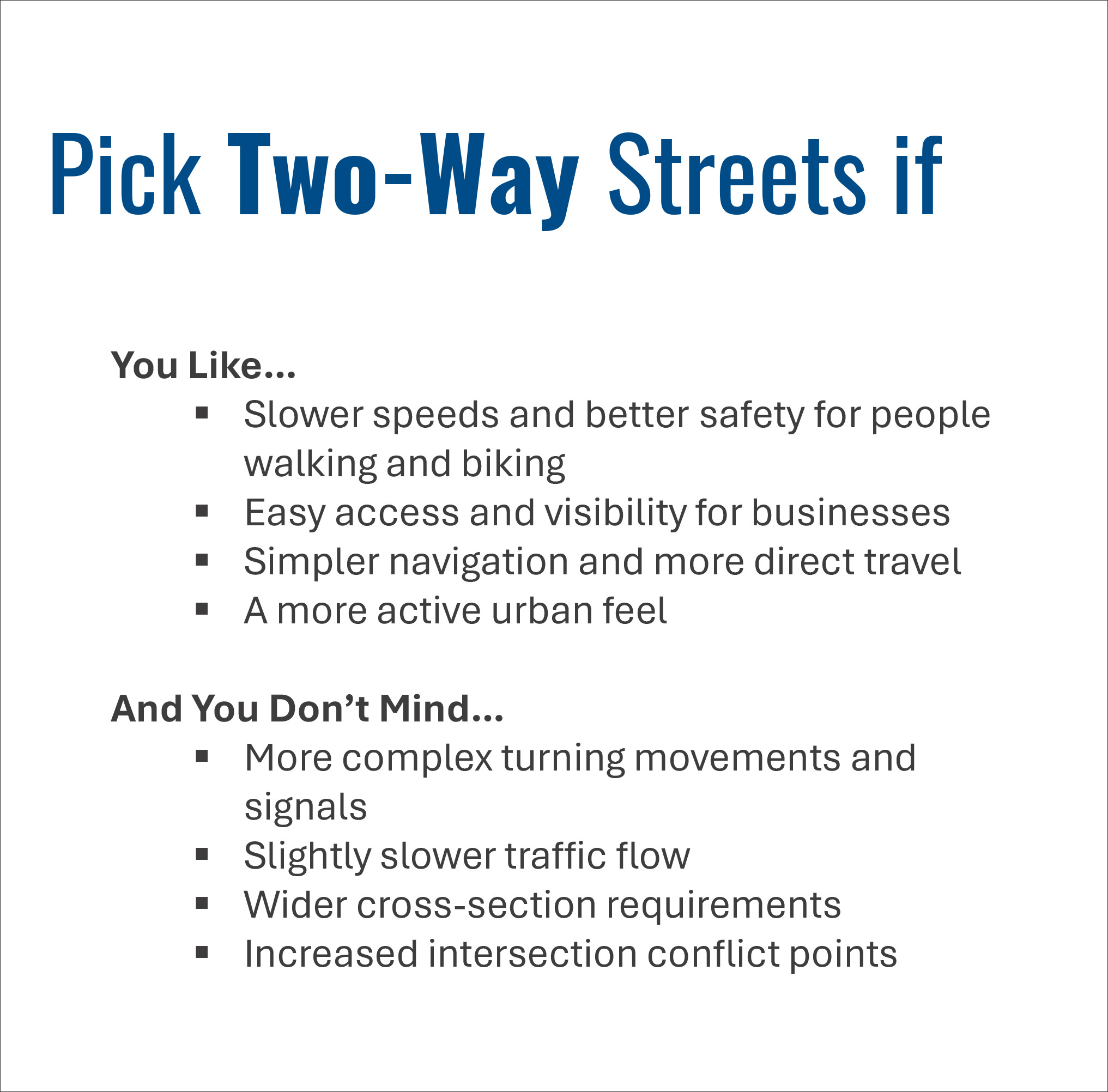
In brief, the consultants offered the following rubric for choosing between a one-way or two-way scenario:
The consultants also presented a summation of the four alternatives in terms of level of investment, level of service for motorists and overall safety.
Public Comment
In public comment, Lisa Pierce noted that when Sebastopol had two-way streets in the past, fully 30% of all accidents happened at the crossroads of Main Street and Bodega Avenue. After the change to one-way streets, accidents declined 37%. Steve Pierce suggested, among other things, losing a lane on Main Street as a way of widening sidewalks and making downtown more beautiful and appealing. Gavin Waters objected to the car-centric as opposed to human-centric approach of the whole project. Tor Allen suggested a return to parklets—those little bulb-out seating areas in what are now parking spaces. Allen also asked the consultants whether they’d done any 3D modeling to make it easier to understand the effects of these various options. (Answer: No, they had not.) Emily Shartin of the Sonoma County Bicycle Coalition said she appreciated the idea of protected bike lanes but still had some concerns about areas where cars and bikes might come into conflict.
Thoughts from the planning commission
The planning commission’s main job that evening was to analyze the consultant’s evaluation criteria and see if anything had been left out. The consultants offered the following list of criteria for judging the various alternatives:
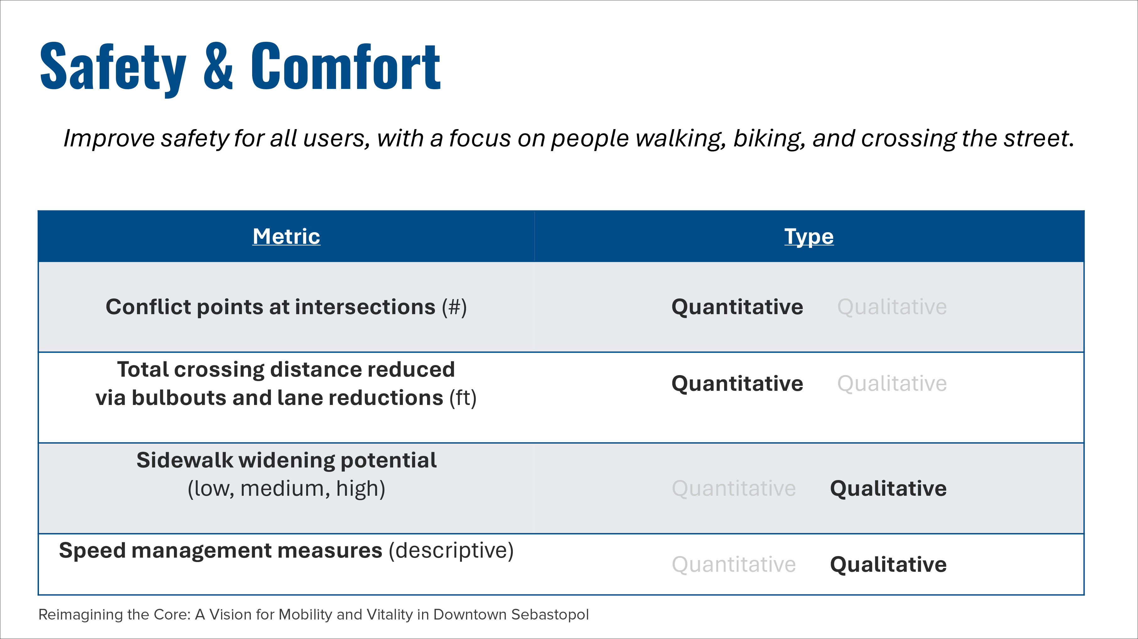
Safety & Comfort
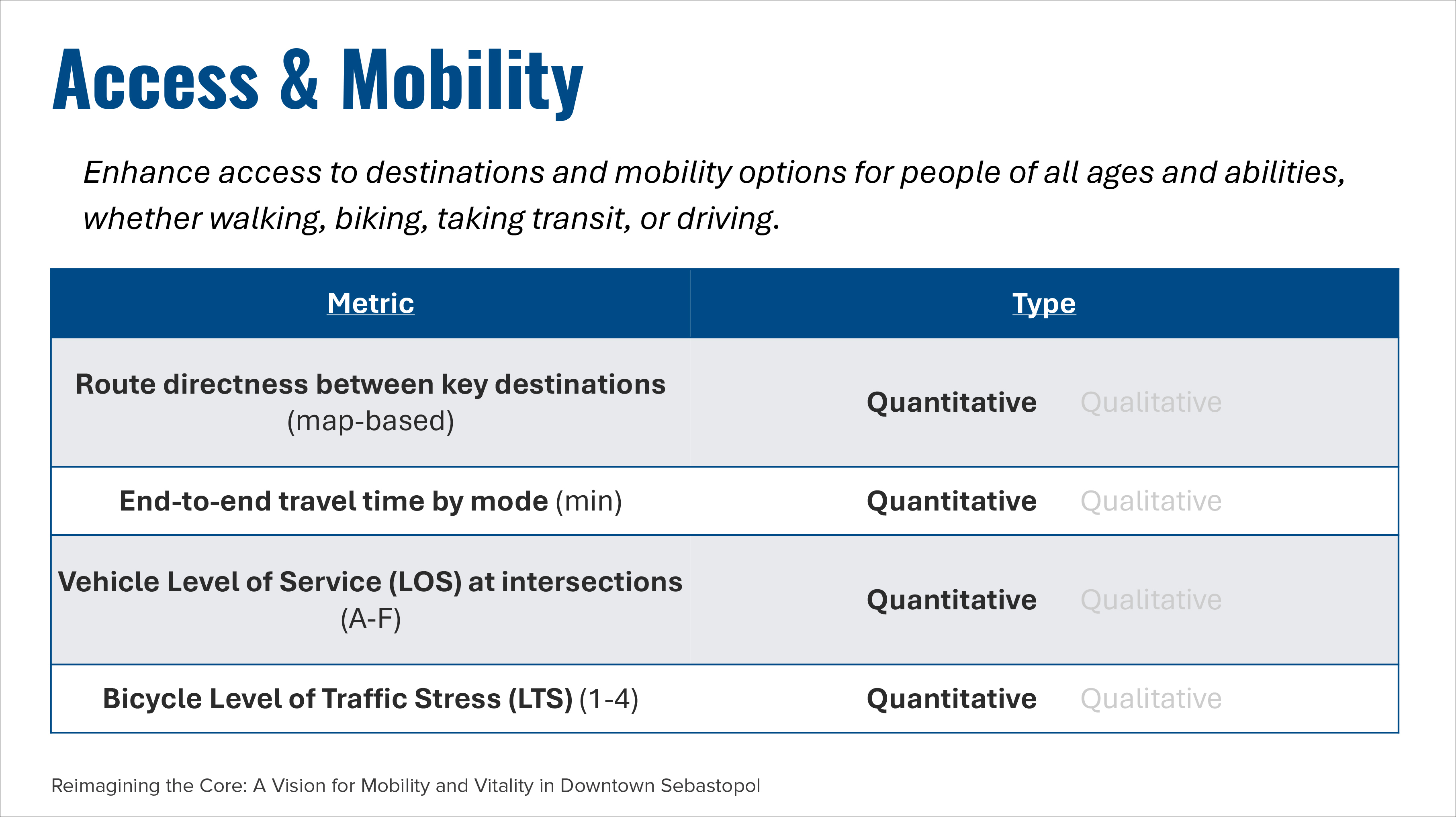
Access & Mobility
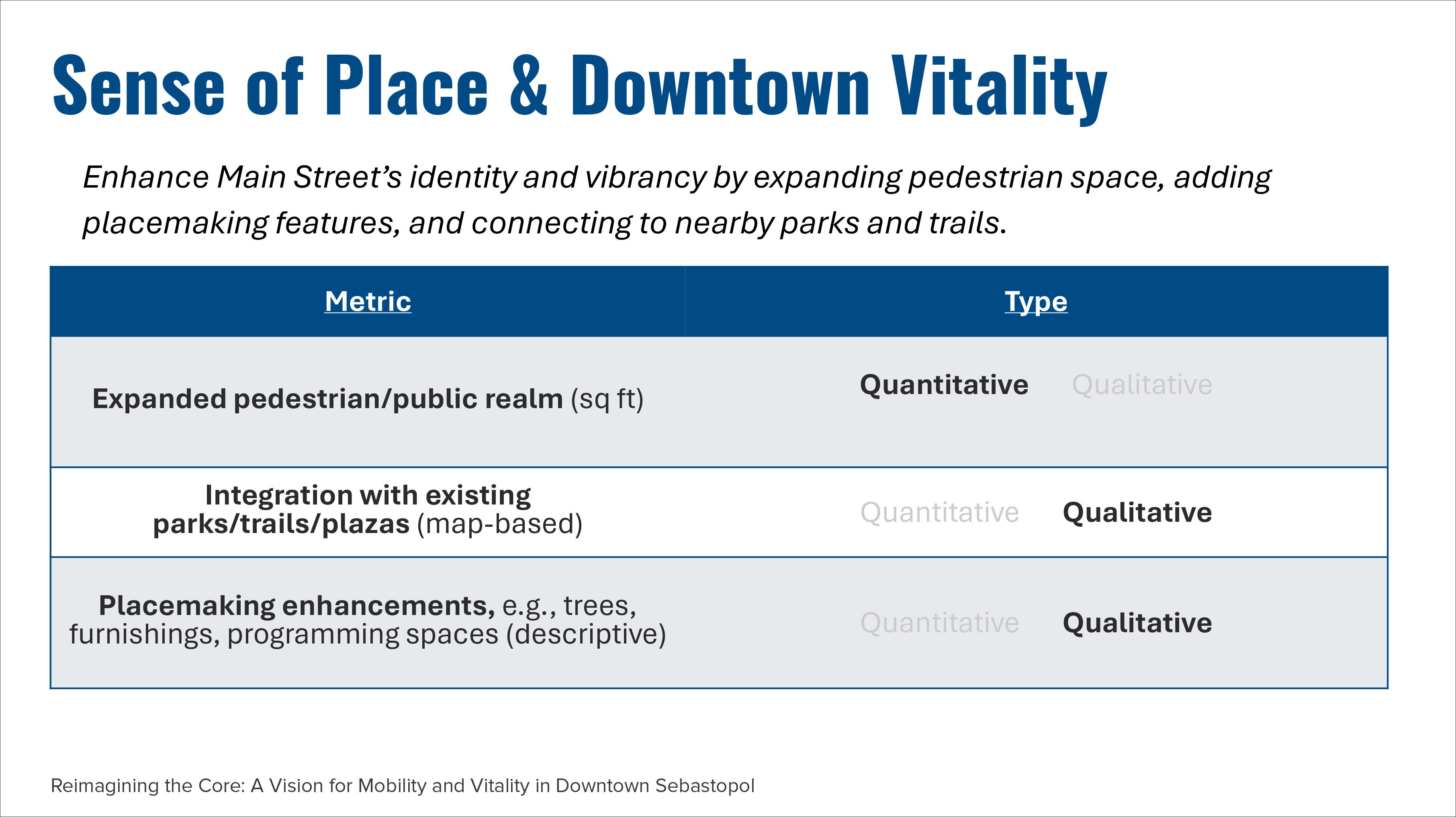
Sense of Place & Downtown Vitality
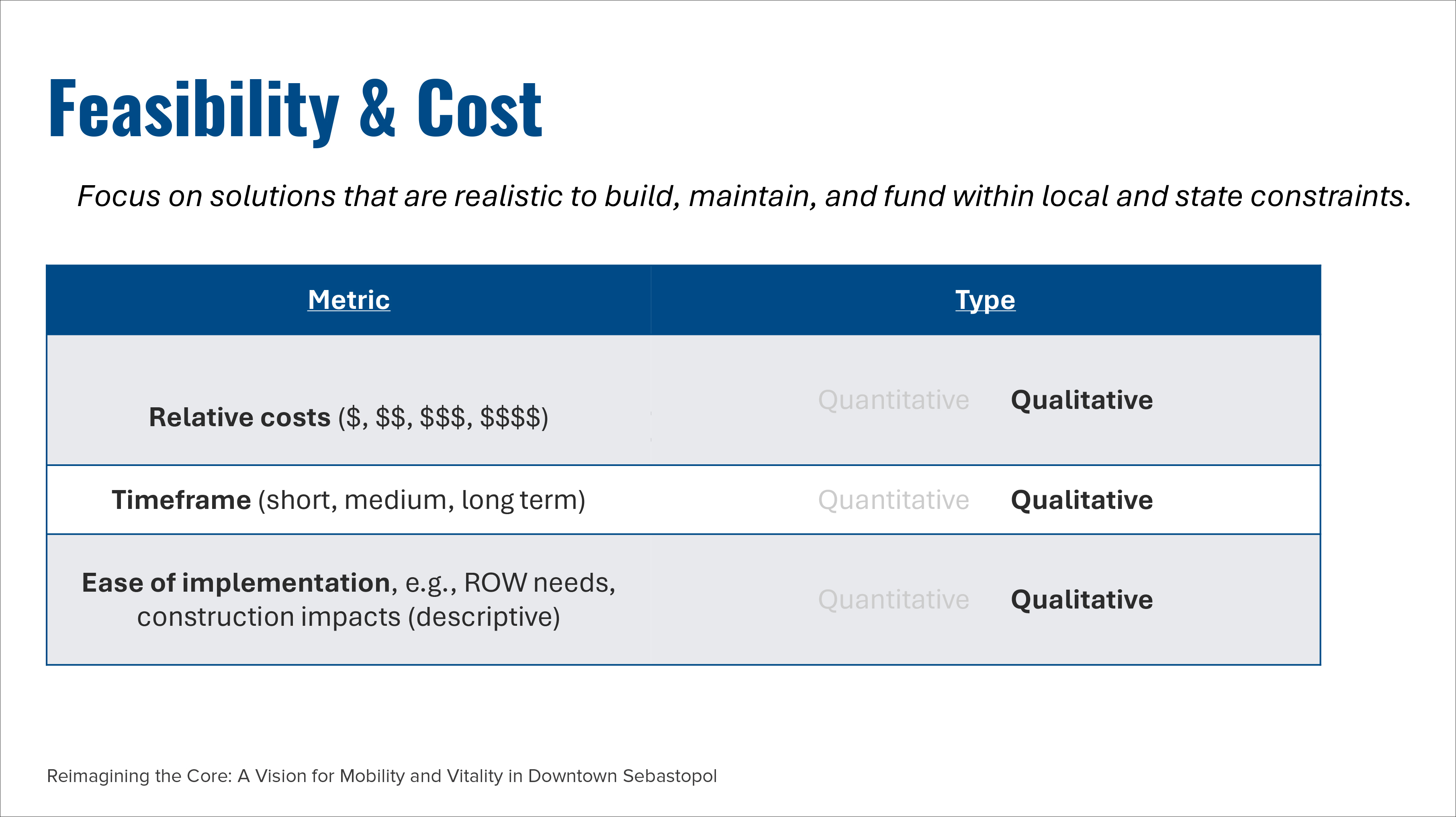
Feasibility & Cost
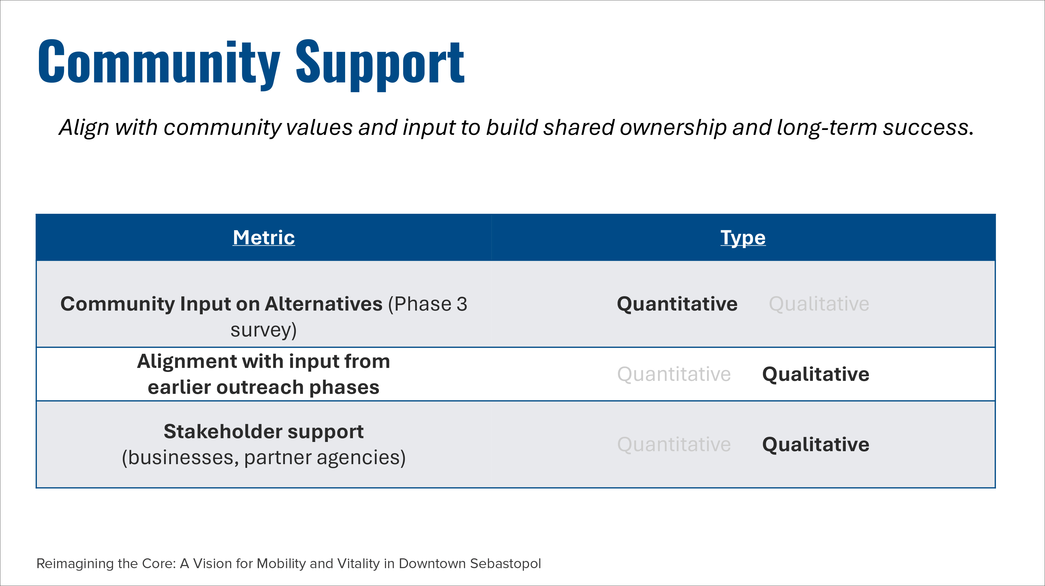
Community Support
Each criterion was filled out with quantitative and qualitative metrics, like so:
In the end, the planning commission added three other metrics, including:
parking
landscaping/green space inclusion
compatibility with the idea of closing off Main Street a few times a year for festivals
“It kind of concerns me that the parking piece is the next-to-final step, instead of being integrated into the entire overall project,” said Planning Commissioner Jennifer Koelemeijer. “Because if we want to build a really vibrant downtown that is more walkable and that brings people in, you have to, in collaboration with that, identify where they’re going to park and how to make that efficient for them.”
Koelemeijer was also the one who asked to add a consideration for the amount of space available for landscaping.
Planning Chair Paul Fritz concurred with the landscape suggestion. “I think these have to go together, because you could have 15-foot-wide sidewalks, but you might not want to walk down that sidewalk if there's no trees or there's no place to sit.”
“One of the core reasons I was excited about this grant opportunity was to build that sense of place and vitality downtown,” Fritz continued. “If we make some place people want to be, people will go there, and that is going to support the businesses whether its one-way or two-way.”
“Build it and they will come,” he joked.
Fritz was also, as always, dismissive of the traffic issue.
“I feel like no matter what we do, people complain about traffic,” he said. “People complain about traffic today if we do nothing, people will complain about traffic if we do something. No matter which of these four options we do, people will complain. No matter what the level of service is or how long the VHT [vehicle hours travelled] is, people will complain about traffic.”
The final vote and where we go from here.
There were only three commissioners (a bare quorum) present on Tuesday evening—Fritz, Koelemeijer, and Kathy Oetinger—but they voted unanimously to accept both the four alternatives and the metrics, with the inclusion of the addition of the three items above.
Here are the next steps: The consultants from Fehr & Peers will conceptually build out and analyze the four alternatives. Then, this fall, the planning commission will make a recommendation to the city council about which alternative it thinks is best. Once the council decides on its preferred alternative, the consultant team will develop an implementation plan and a draft final plan and take it to city council for final approval in early 2026.
Where to after that? That’s when the search for funding to turn these plans on paper into material things in the real world will begin in earnest.
Laura, thank you for handling this complex subject in a clear and understandable way.
I am concerned about parking. I often don’t stop downtown because there is no parking anywhere. This hurts businesses.
Also, I understand the need to protect people on bikes, but as I drive on Petaluma Avenue, the bike lane is very rarely if ever used. Traffic backs up which is a bit annoying. Sorry to say.