

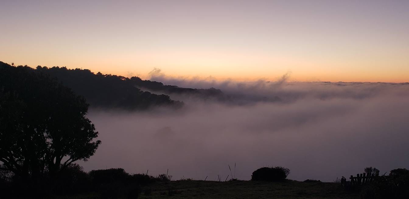
There’s a window most mornings in June when Coleman Valley Road goes from full sun to soft gray inside a quarter mile, and the air gets so wet your bumpers bead before you crest the next rise. Out past Occidental, the redwoods stand with their crowns dipped into cloud, the sword ferns underneath them dripping like it just rained. By mid-morning, the marine layer slides back toward Bodega Head, and the canyon air smells like salt and bay laurel. For anyone who grew up west of 116, that’s what summer is.
What’s harder to admit is that it’s been getting less reliable for 75 years. West Sonoma County sits inside one of the most carefully measured fog belts on the planet, and the summer fog that made Bohemian Highway feel like its own microclimate has thinned by about a third since the 1950s.
According to UC Berkeley plant biologist Todd Dawson, coastal California has lost about 35 percent of its summer fog since 1951. In raw hours, that’s roughly nine hours a day in fog season now versus 12 hours a day in the 1950s and 60s. “Since about 2014, there are more fogless days, which were very rare in the past,” Dawson said. “In the past two decades, we no longer can say what is really ‘normal.’”
Based on work done at the Grove of the Old Trees, eight kilometers west of Occidental, Dawnson and Jim Johnstone co-authored a paper in 2010 that put Sonoma County on the fog-science map. (You can read about their work here. )
After that study, however, the science went quiet for a decade. The Grove itself—the ridgetop redwood preserve where they first measured the disappearance—hasn’t been actively sampled in more than a decade.
“Redwood work involving my group ended at the Grove about 13 years ago,” Dawson says. “I do not think any new sapflow or leaf wetness data have been collected there.”
What's changing in 2026 is that the funding finally caught up. In October, the Heising-Simons Foundation announced a $3.7 million, five-year research collaboration called Pacific Coastal Fog Research, with five principal investigators from Indiana University to Scripps to SF State to CSU Monterey Bay.
Daniel Fernandez at CSU Monterey Bay already has 15 fog collectors deployed along the California coast as the project gets started. Sara Baguskas at San Francisco State is building out instrumentation across redwood, maritime chaparral, agriculture, and bluff-scrub sites.
Dawson told the Monterey Herald last November that this work “is going to improve our understanding about what really is happening to fog.”
The West County piece of this isn’t theoretical. Pepperwood Preserve, up in the hills northeast of Santa Rosa, is running what it calls a Sentinel Site — mesh fog-catchment systems paired with a partner installation at Bodega Marine Lab, sampling the coast-to-inland gradient that runs straight through Forestville, Sebastopol, and Cotati.
“We are monitoring fog events using mesh catchment systems at Pepperwood and Bodega Marine Lab to capture the coastal to inland gradient and fog timing, duration, and quantity,” ecology research manager Michelle Halbur says. Pepperwood is also part of Fernandez’s collector network.
Why any of this matters for a Sebastopol resident comes down to a US Geological Survey regression that’s been quietly sitting in a 2015 conference deck for a decade. Working a transect from Bodega Head to Pepperwood, USGS scientist Alicia Torregrosa found that each additional hour of fog per day cools a station by an average of 0.4 degrees Celsius. At Santa Rosa, the cooling from a single extra fog-hour matched the full warming the climate models project for the city by 2100. Put another way: one hour of fog, gained or lost, is worth a century of climate change.
And here’s the part most people miss: fog isn’t just water. It’s a delivery system. Peter Weiss-Penzias, an atmospheric chemist at UC Santa Cruz and one of the five Pacific Coastal Fog Research investigators, has spent more than a decade measuring what California coastal fog actually carries — nitrogen, sulfur, sea-salt aerosols, and, less reassuringly, mercury. His group has documented elevated methylmercury concentrations in fog water at sites from Trinidad Head to Big Sur, and traced that mercury up the food web into wolf spiders and camel crickets that hunt and forage in the fog zone.
A 2019 review Dawson co-authored called fog a “medium, vector, and connector.” The redwoods drink nitrogen out of it that ends up in their wood; the lichens and mosses absorb whatever falls on them; the rest of the food web either benefits or doesn’t, depending on what else is along for the ride.
This has implications for two important Sonoma County plant species—one native, one agricultural:
Redwoods get 30 to 40 percent of their annual water from fog, and recent genetic work shows Sonoma County’s redwoods are distinct from the populations south of San Francisco Bay — they can’t be replaced by transplanting from Big Basin.
The Russian River Valley and Green Valley wine region—and the cool-climate pinot and chardonnay they produce—are dependent on a marine layer that’s getting less reliable every decade.
What’s quietly remarkable is how much of the field is concentrated within an hour of Sebastopol. The original measurements happened on a ridge near Occidental. The current monitoring runs across West County from Pepperwood to Bodega. The local lichenologist with the deepest fog-belt expertise works in Sebastopol and Petaluma.
The only place in California where redwoods are now using measurably more groundwater than they did in the mid-2000s—Dawson’s current, unpublished finding—is the dry eastern edge of Sonoma and Mendocino counties. The trees are reaching deeper because the fog that used to spare them from needing to isn’t coming as often.
Roger Coryell is a journalist covering Sonoma County. Reach him at roger@rogercoryell.com or (707) 892-3953.

Awesome article! In my middle age I have rediscovered a strong love for science, and I'd love to see more coverage of the science being done here in West County.
Great write up and read out! Very clear and informative. One question, it didn't sound from the article like any of the new funding was being used to measure at the Grove of the Old Trees, Occidental? Would be great to compare to the old data from 13 years ago.
PS: was a beautiful foggy morning today!